|
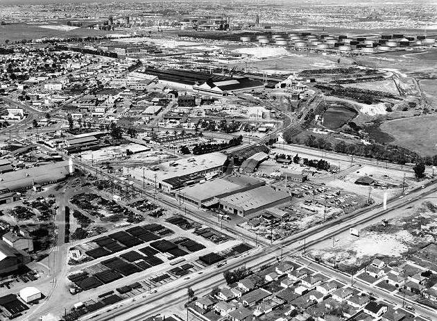
Western Ave / 213th Street: 19?? |
|
|
|
This is an aerial photo of the area northwest of the intersection of Western Avenue and 213th Street. The camera is pointing northwest. In the foreground, a few of the Union Tool Company buildings are shown in the middle-left of the photo. In the middle of the photo, the Columbia Steel mill is shown. The Pacific Electric shops are shown above and to the left of Columbia. Also, the Pacific Electric / Torrance Blvd viaduct can be seen in the lower-middle of the picture. In the distance, the Mobil Oil (now ExxonMobil) refinery tanks are visible. Judging by the increased density in the photo, my best guess is that this photo was taken sometime in the late 1950's or early 1960's. |
