|
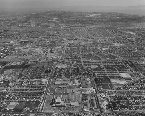
South Bay Galleria Area: 1962 |
|
|
|
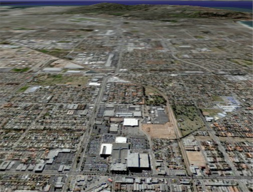
This is an aerial photo from 1962 over north Redondo and Torrance. The photo was taken with the camera facing south. The South Bay Center (which was later expanded to become the South Bay Galleria) is in the lower center of the photo. The Center split what is now Redondo Beach Boulevard and Grant Avenue into two separate roads. Also visible in this photo are the open spaces of land that would later become Adams Park (technically part of the middle school), Columbia Park, and Old Towne Mall. Off in the distance, the Torrance Airport and the Palos Verdes Peninsula are visible. Below is a view of the same area in 2005 ...
|
|
|