|
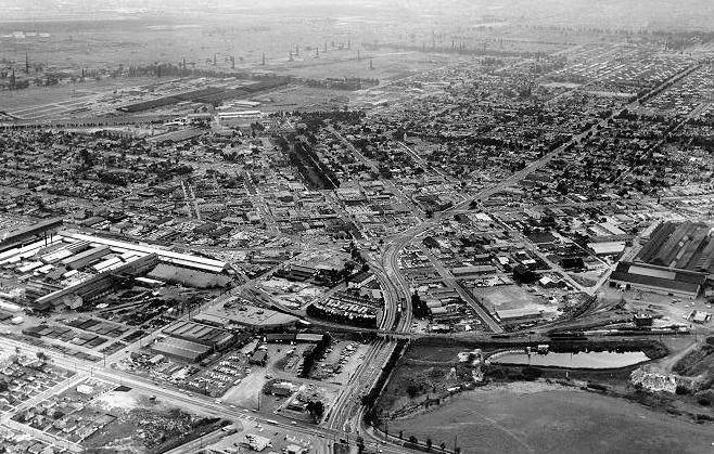
Downtown Torrance: 1957 |
|
|
|
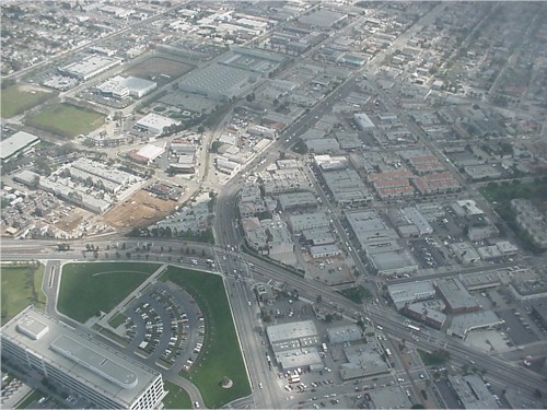
This is an October 1957 aerial photo of downtown Torrance. The camera is facing southwest. Western Avenue runs along to bottom of the photo. The Union Tool buildings are in the middle-left, and the U.S. Steel buildings are in the middle-right. The future Wilson Park will be located on the the site of the U.S. Naval Reserve airstrip in the upper-left of the photo. The Pacific Electric / Torrance Blvd viaduct is visible in the lower-middle of the photo. Here's a photo I took of the same area from the Goodyear airship Eagle in 2000 ...
|